A strong architectural concept does not begin with form alone. It begins with the site: where the sun moves, where wind comes from, how people arrive, what surrounds the property, and which physical conditions can support or constrain the design.
For architecture students, designers, and planning teams, an architecture site analysis organizes those conditions into evidence that can inform orientation, massing, openings, circulation, outdoor space, and early programming. Study Site Mapper brings several of these mapped products into one mobile workflow, helping you prepare a clear preliminary site study before moving into detailed design.
Study Site Mapper is available on the App Store and Google Play. Choose a location, load a relevant layer, compose the map, and export a PNG or PDF from your phone.
What belongs in an architecture site analysis?
The exact checklist depends on the project, climate, scale, and course or client requirements. A useful initial analysis often considers:
- site location, boundary, dimensions, and broader urban or rural setting;
- sun path, solar direction, sunrise, and sunset;
- wind speed, prevailing direction, and seasonal variation;
- roads, access points, movement networks, and nearby connections;
- surrounding building use, height, density, and neighborhood character;
- elevation, slope, topography, vegetation, drainage, and water; and
- views, noise, hazards, utilities, zoning, codes, and field observations.
No single map answers all of these questions. The goal is to assemble several focused views, then interpret them together. A mapped product is most useful when it leads to a design question: Which façade needs stronger solar control? Where might cross-ventilation be explored? Which edge is most connected to the street? How does the surrounding building pattern influence scale and access?
1. Read sun path and solar direction
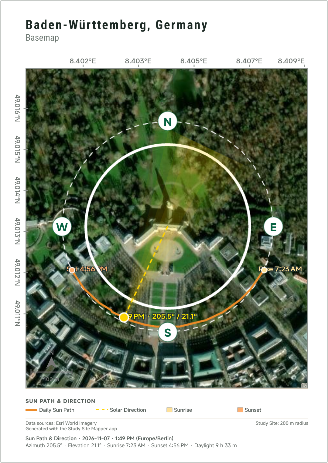
The Sun Path & Direction layer shows the daily solar arc for the selected date, the sun's direction for the chosen time, and local sunrise and sunset. Placing this information over imagery makes orientation easier to discuss in relation to the actual site and its surroundings.
Use the map to begin comparing building orientation, exposed façades, possible shaded zones, outdoor-space placement, and daylight opportunities. Then test those ideas at relevant dates and times rather than relying on one screenshot. Solar access is also affected by nearby obstructions, building geometry, glazing, materials, and local conditions, so detailed design still requires project-specific simulation and field verification.
2. Examine wind speed and prevailing direction
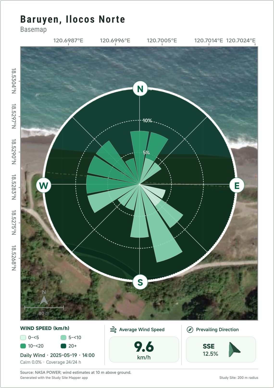
The Wind Direction and Speed product uses NASA POWER estimates at 10 meters above ground. Its wind rose groups observations by direction and speed, while the summary identifies the average speed and prevailing direction for the selected day, month, or year.
For an early architectural study, this can support questions about natural-ventilation potential, the orientation of openings, sheltered outdoor areas, and which site edges deserve closer investigation. Treat it as broad climatic context—not a prediction of air movement between buildings. Trees, terrain, street canyons, walls, and the proposed massing can alter wind at pedestrian and opening level. Critical design decisions need on-site observation and, when appropriate, more detailed wind analysis.
3. Map roads and access context
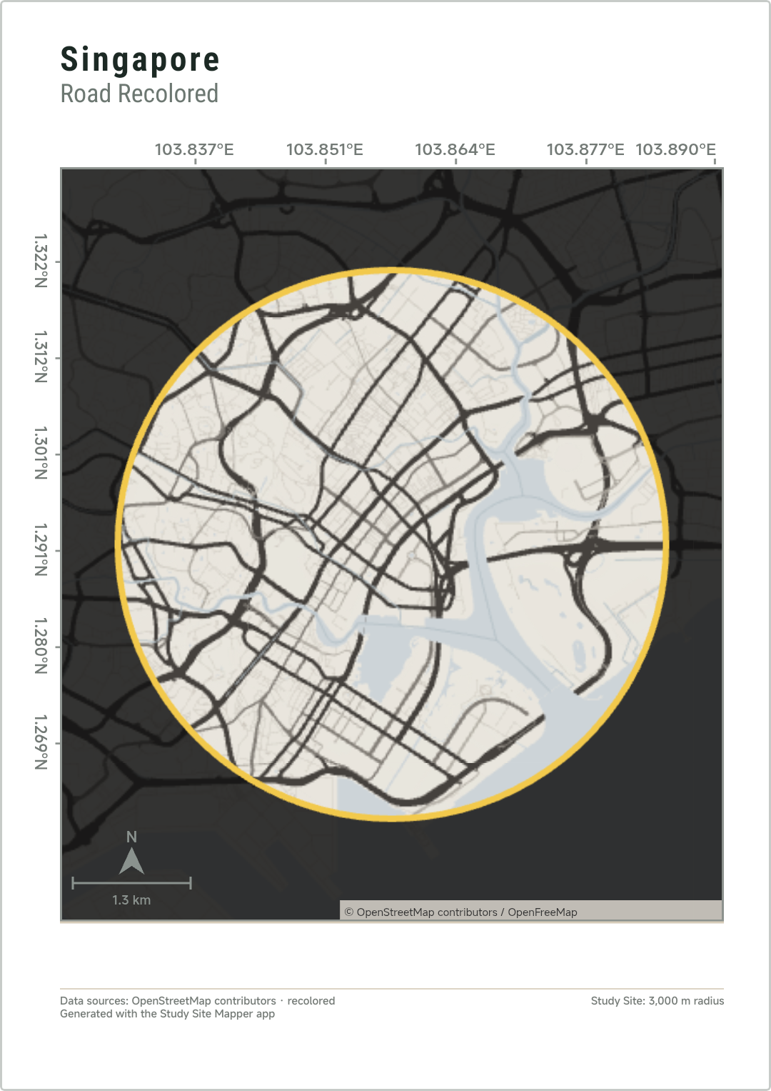
Road patterns reveal how a site connects to its surroundings. Study Site Mapper's recolored road maps can simplify the visual hierarchy, making major connections and local street structure easier to read in a presentation plate.
Use this view to mark possible arrival routes, pedestrian and service approaches, adjacent intersections, barriers, and connections to the wider district. A road map does not establish legal access, road width, traffic volume, ownership, or right-of-way. Confirm those details through current local records, fieldwork, and a proper survey.
4. Understand surrounding building use
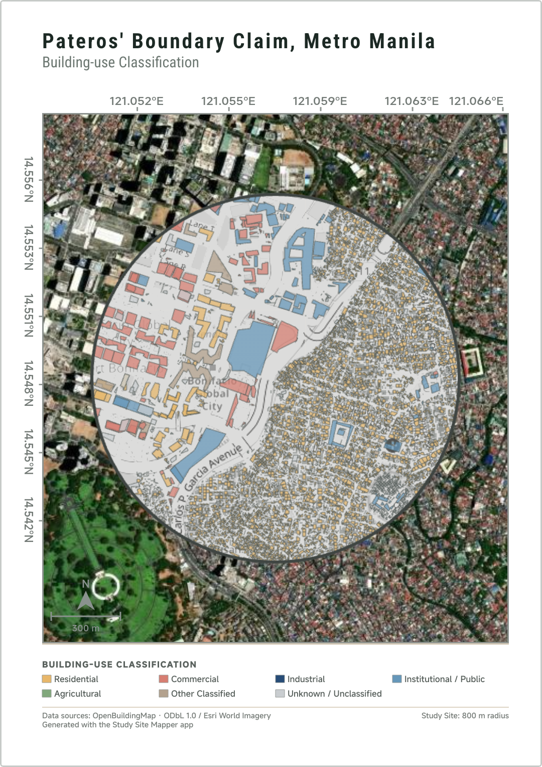
Building-use Classification maps available OpenBuildingMap categories such as residential, commercial, industrial, institutional or public, agricultural, other classified, and unknown or unclassified buildings. This can help reveal the broad mix of activities surrounding a project site.
That context matters when developing preliminary questions about compatible uses, active edges, privacy, service access, public interfaces, and transitions between different parts of the neighborhood. Coverage and classification completeness vary by place, and an unknown building is not evidence of a specific use. Verify important properties on site and against authoritative planning or land-use information.
5. Compare the height and scale of nearby buildings
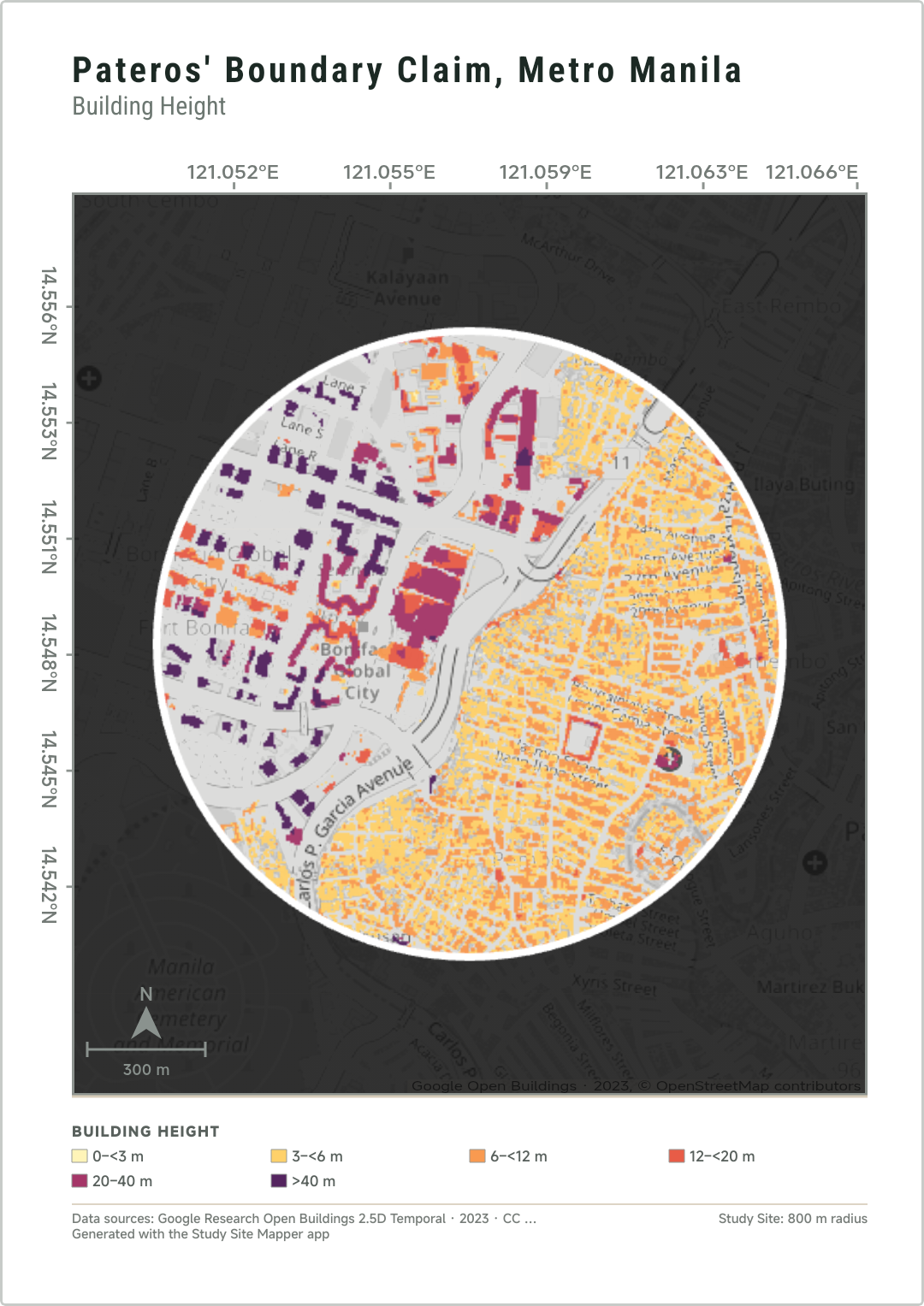
Where source coverage is available, the Building Height layer groups nearby structures into height ranges. It can help you recognize broad contrasts between low-rise fabric, larger blocks, and taller clusters—useful context for early massing, views, shade, privacy, and neighborhood-scale discussions.
The layer is not a substitute for measured building elevations or a current site survey. Treat it as a contextual screen that helps identify where more detailed documentation is needed.
6. Add terrain and topographic context
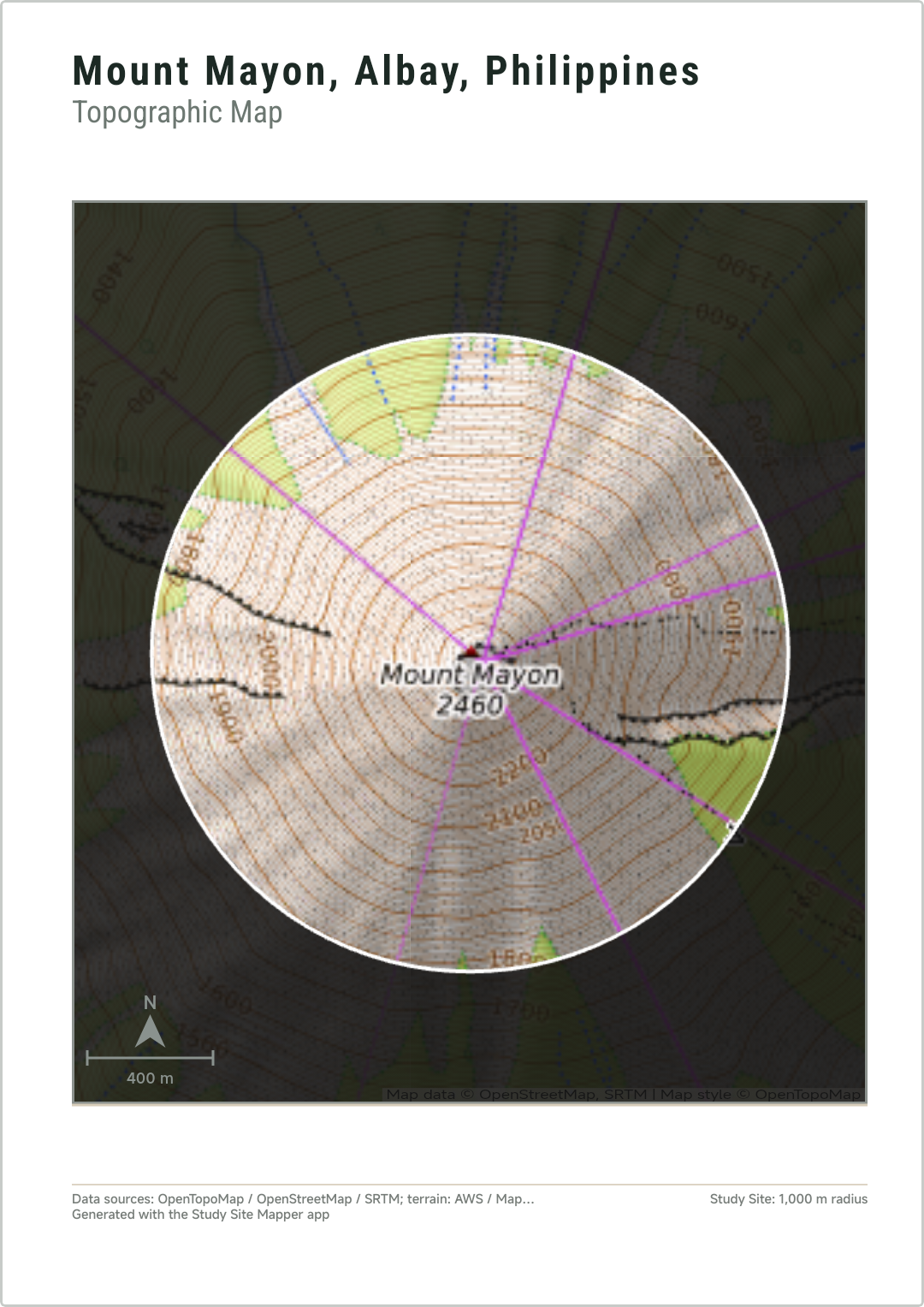
Elevation, terrain slope, relief, and topographic views help describe how the land changes across and beyond a study area. These layers can support preliminary thinking about contours, movement, drainage, view corridors, accessibility, and the relationship between a proposed building and the landscape.
For sloping or complex sites, use these maps to frame questions—not to set finished floor levels, calculate earthworks, or design drainage. Those tasks require a current, appropriately accurate topographic survey and qualified technical input.
A practical workflow for architecture students
- Define the site. Search for a place, enter coordinates, draw a circle or square, choose an available boundary, or import a KML file.
- Set a useful extent. Keep the site visible while including enough surrounding context to explain access, buildings, and environmental conditions.
- Create one map per question. A sun map, wind map, access map, and built-context map are usually clearer than stacking unrelated information into one crowded plate.
- Record the settings. Note the selected boundary, date, time, analysis period, source, and relevant limitations.
- Add field evidence. Verify access, activities, obstructions, vegetation, noise, views, drainage clues, and microclimate conditions on site.
- Translate findings into design responses. Connect each observation to a testable implication for orientation, massing, circulation, openings, landscape, or program.
- Export and compose. Save maps as PNG or PDF and combine them with photos, diagrams, sketches, survey information, and written conclusions in your site-analysis board.
Frequently asked questions
What should an architecture site analysis include?
Start with the location and boundary, then review sun, wind, access, surrounding uses and buildings, terrain, vegetation, water, views, noise, hazards, utilities, and applicable planning controls. Include only what is relevant to the project and explain how each finding affects the design.
Can I study sun path and wind direction on my phone?
Yes. Study Site Mapper can display a selected date and time for Sun Path & Direction and summarize NASA POWER wind estimates for a selected day, month, or year. Both are starting points that should be checked against site conditions and more detailed analysis when decisions are consequential.
Can this replace a professional site survey?
No. Study Site Mapper is useful for preliminary study, mapping, and communication. It does not replace cadastral or topographic surveys, field measurements, code and zoning review, engineering analysis, environmental assessment, or professional judgment.
Study Site Mapper is an educational, research, and general-purpose site-analysis tool. It is not intended for cadastral or professional land surveying, engineering or architectural certification, legal boundary determination, code compliance, emergency response, or authoritative navigation. Dataset coverage, dates, resolution, classifications, and accuracy vary by source.

Build the context behind your next design.
Explore sun, wind, roads, buildings, and terrain—then export focused maps for your architecture site-analysis board.