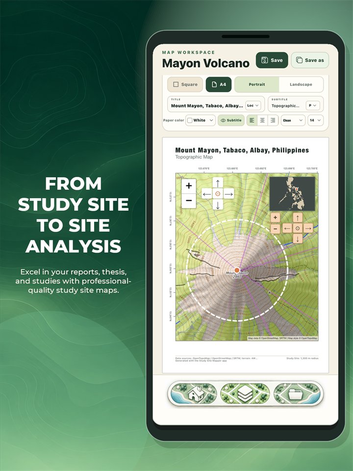
STUDY AREA MAPPING, IN YOUR POCKET

Map smarter withStudy Site Mapper

Create clear study-area maps directly from your phone. Select a site, explore ready-to-load thematic layers, review mapped-area data, and export a polished PNG or PDF.

iOS + Android30+ map layersNo account required
Map with 30+ geospatial layers.
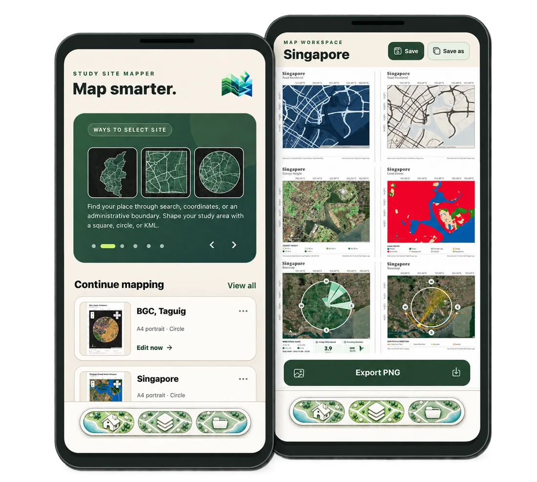
Two phones showing the Study Site Mapper home screen and map workspace
Map. Explore. Export.
NOW AVAILABLE ON IOS AND ANDROIDStudy Site Mapper app icon

Your study area.
Just a few taps away.

Map smarter, faster using your phone. One app for study-area selection, thematic maps, mapped-area statistics, and PNG or PDF export.

Download on theApp StoreGET IT ONGoogle Play

iPhone and Android · Paid app · No account required

BUILT FOR MAPPING ON THE MOVE

A complete mapping workflow.
Designed for your phone.

Swipe through the app experience—from choosing a site to exploring layers, reviewing data, and preparing a site analysis.

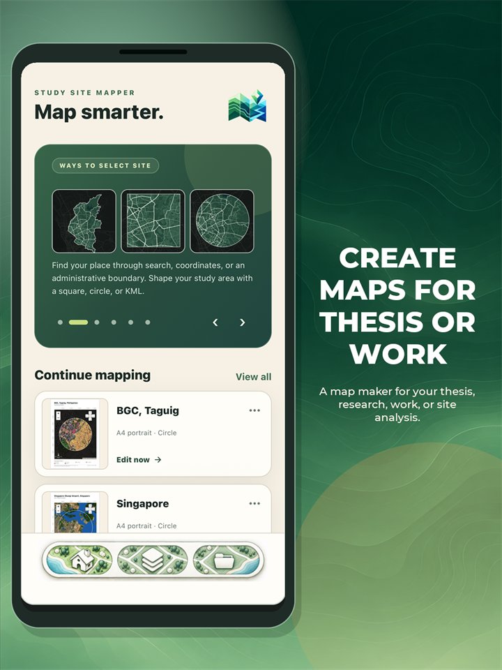
Study Site Mapper home screen with saved mapping projects
Start with your siteProjects stay organized and ready to continue.
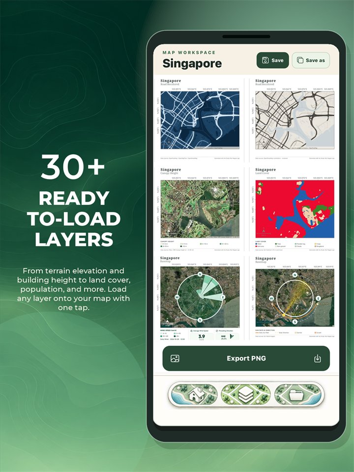
Study Site Mapper showing more than 30 ready-to-load map layers
Choose a focused layerExplore environmental, landscape, and socioeconomic context.
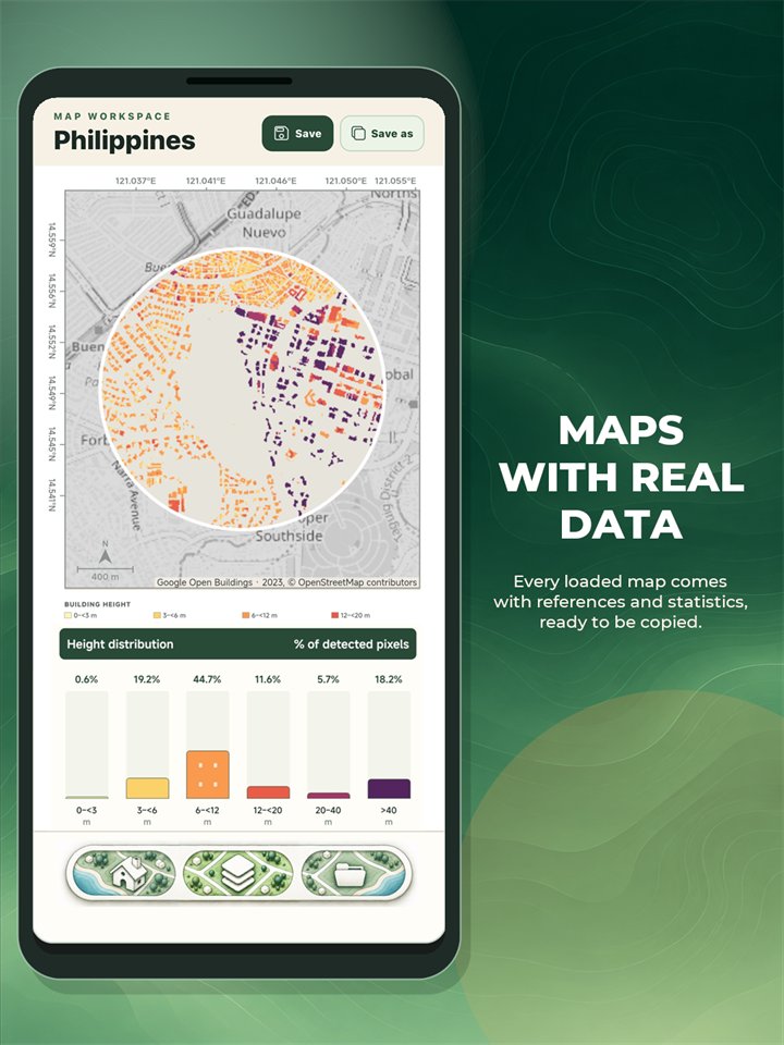
Study Site Mapper building map with a data chart
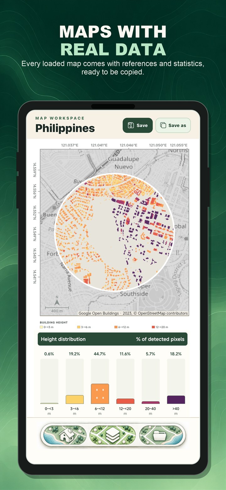
Review mapped dataSee available counts, percentages, and source notes.
Study Site Mapper sun-path analysis and location inset
Build a site analysisCombine map layouts and thematic perspectives.
01 / THE WORKFLOW

From a site to a finished map.

No GIS learning curve required. Move from location to clear, presentable output without leaving the app.

01

Choose your study area

Search for a place, use your location, enter coordinates, or load a province or KML boundary.

02

Design your map

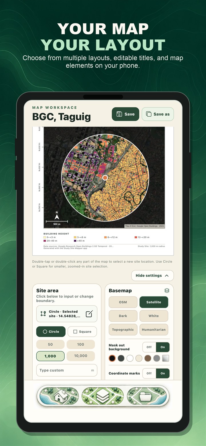
Choose a layout and basemap, then add your title and map elements.

03

Pick a map layer

Explore environmental, landscape, and socioeconomic layers for your site.

04

Map, measure, export

Switch between Main Map and Loaded Data for statistics, then save your project or export a PNG or PDF map.

02 / CHOOSE YOUR FORMAT

A4 or square.
Your map, your layout.

Choose A4 portrait, A4 landscape, or a square plate to fit the way you present your study site.
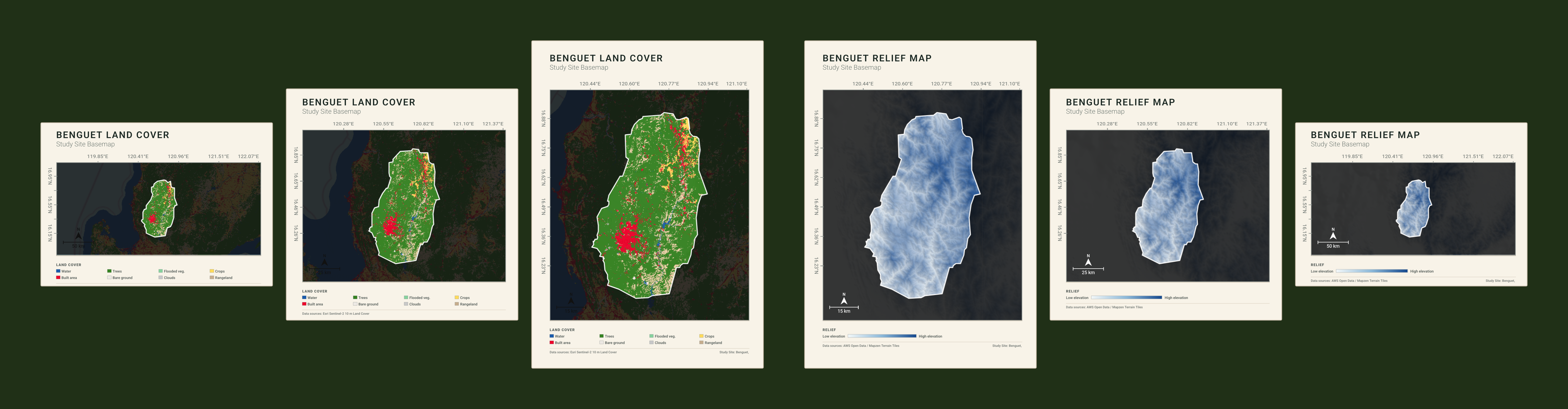
Benguet land-cover and relief maps shown in A4 landscape, square, and A4 portrait layouts
Benguet examples · A4 landscape · Square · A4 portrait
03 / THEMATIC VIEWS

Explore what matters to your site.

Start with a clean basemap. Add a focused data layer that helps answer your study question.

01 / ENVIRONMENT

Read the land.

See ecological patterns and water features within your selected study area.

  • Land Cover & River Network
  • Mangrove & Seagrass Extent
  • Aboveground Biomass
  • Forest Type & Water Bodies
02 / LANDSCAPE

Understand the terrain.

Bring elevation, slope, height, solar resource, and site orientation into view.

  • Elevation & Terrain Slope
  • Relief & Topographic Maps
  • Canopy & Building Height
  • Solar Resource & Sun Path
03 / SOCIOECONOMIC

Add human context.

Explore population and building-use patterns with source notes and mapped-area statistics.

  • Population Density · 100 m
  • Dominant Age Range & Sex
  • Building-use Classification
  • Charts, Counts & Percentages
04 / ONE WORKSPACE, TWO VIEWS

The map you make.
The data behind it.

Main Map gives you the visual story: site boundary, thematic layer, coordinates, legend, and a composed page. Loaded Data brings in source notes and available statistics for the selected area.

A
Main MapCompose, inspect, and export the map.
B
Loaded DataReview mapped-area figures and data sources.

Statistics are layer-dependent estimates and should be checked against source data for formal analysis.
05 / LATEST MAP EXPORTS

Real places. New perspectives.

Recent map plates exported from Study Site Mapper, showing the range of geographic context available within one mobile workflow.
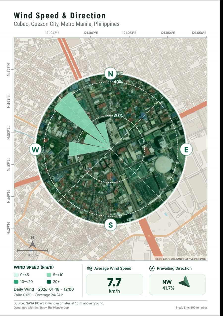
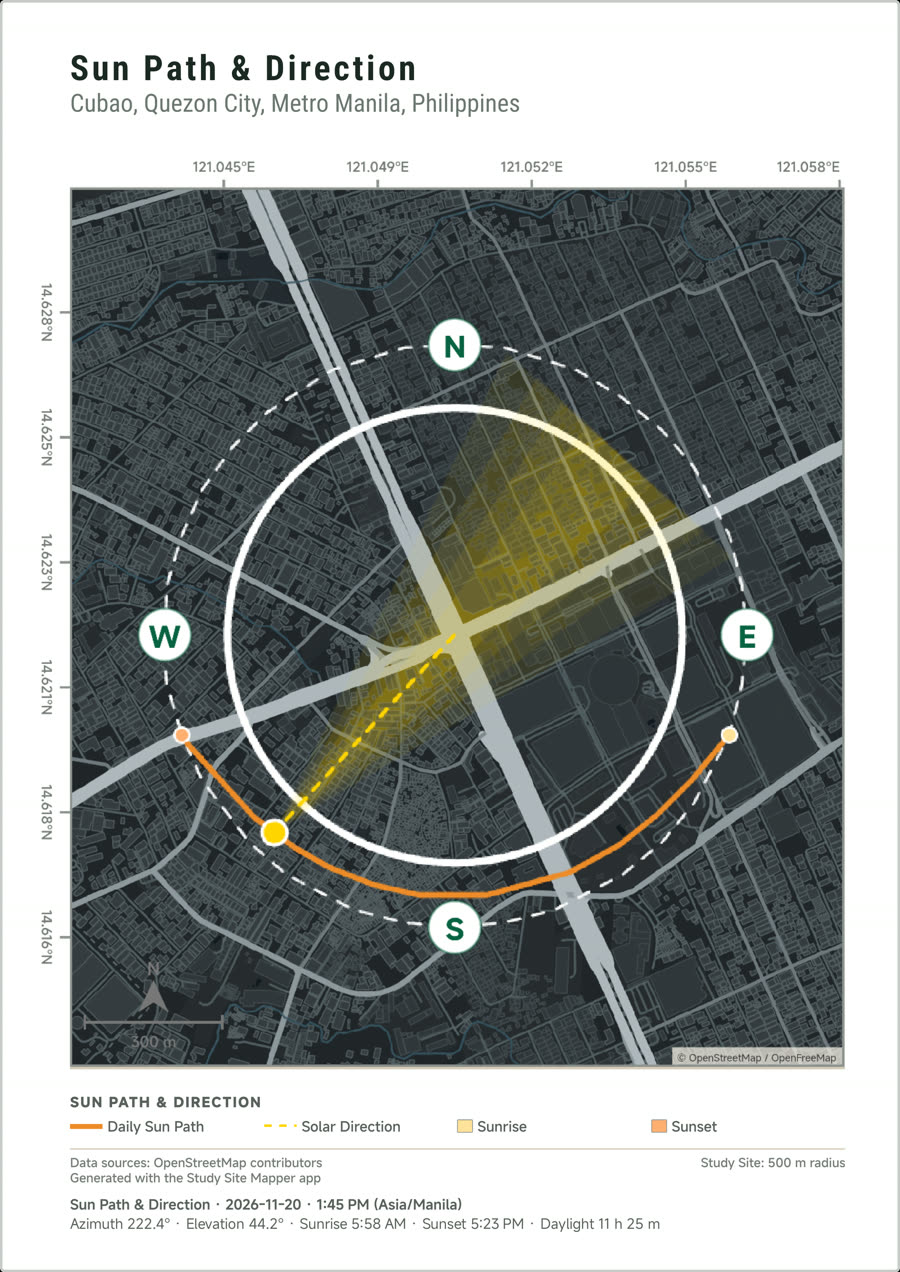
Wind speed and direction map of Cubao exported from Study Site Mapper
Cubao, Quezon CityWind Speed & Direction
Sun path and direction map of Cubao exported from Study Site Mapper
Cubao, Quezon CitySun Path & Direction
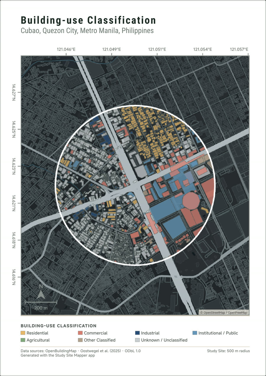
Building-use classification map of Cubao exported from Study Site Mapper
Cubao, Quezon CityBuilding-use Classification
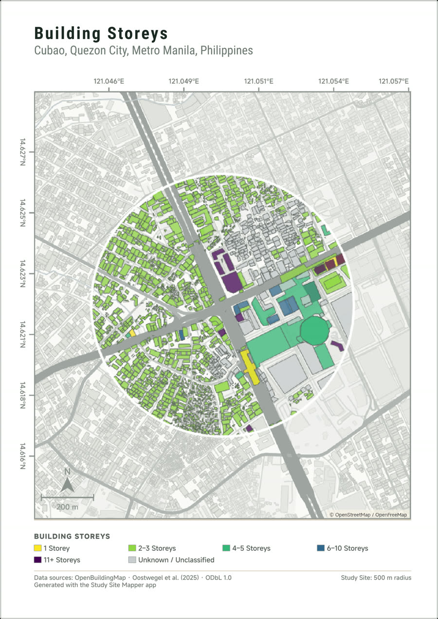
Building storeys map of Cubao exported from Study Site Mapper
Cubao, Quezon CityBuilding Storeys
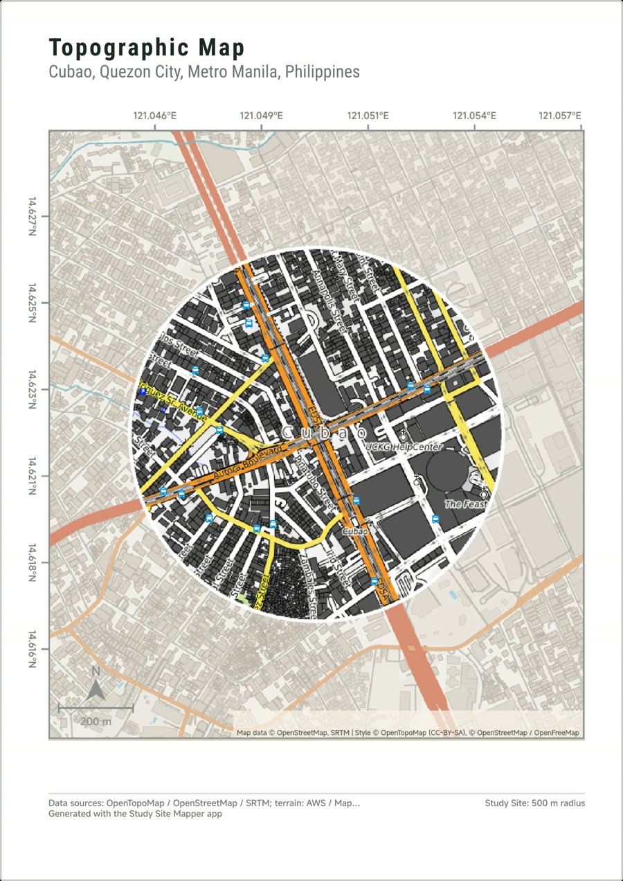
Topographic map of Cubao exported from Study Site Mapper
Cubao, Quezon CityTopographic Map
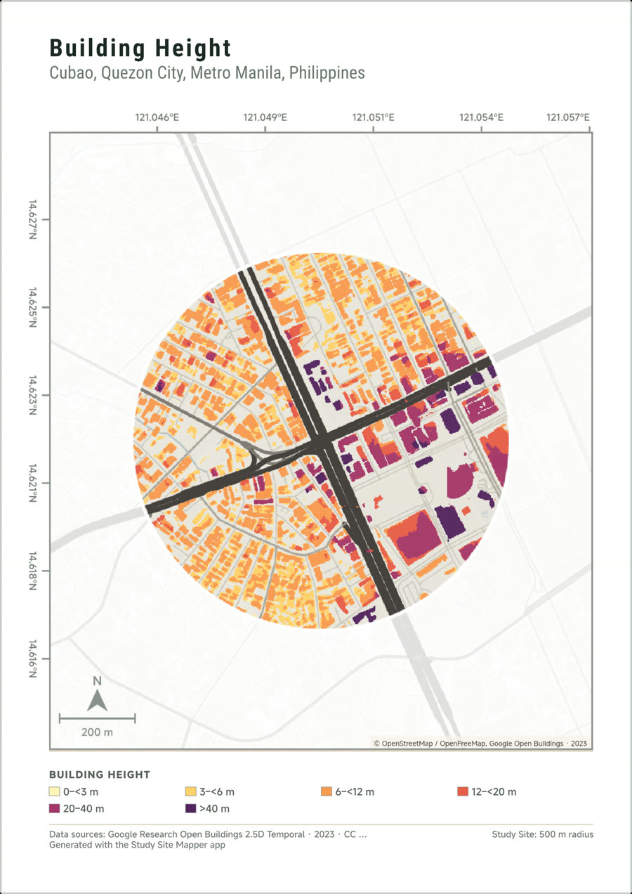
Building height map of Cubao exported from Study Site Mapper
Cubao, Quezon CityBuilding Height
YOUR NEXT SITE STUDY STARTS HERE

Map smarter with
Study Site Mapper

Build your next study area map with ready-to-load layers, mapped-area data, and professional PNG or PDF exports.

Study Site Mapper folded map and location-pin mark